
Compiled by Joanne Plescia, PhD
It is thought that during the 1600s Captain Robert Hart sailed from England or a nearby port, to the area around the now Delaware Bay. With the voyage taking between 6-12 weeks, his mission is believed to have involved charting the coastlines and identifying potential sites for settlement and trade. During this time, European powers, especially the English, Dutch, and French, were heavily involved in exploring and colonizing various parts of North America. The Delaware River was significant for early exploration as it served as a vital transportation route for goods and people. Various explorers, including the Dutch and the Swedes, were known to have navigated the Delaware during this time in ships that traveled across the Atlantic primarily designed for trade, exploration, and colonization. To accomplish these tasks a variety of ships were needed. Typically, smaller vessels, called Barks weighed 50 to 200 tons, and carried approximately 10 to 30 men. Slightly larger ships called Carracks ranged in size from 100 to 400 tons and were manned by 60 to 150 men. Galleons could range from 200 to 2,000 tons and carried 200 to 400 persons. It is likely that Captain Hart sailed on a Carrack or Galleon to explore the region known today as Slaughter Beach.
The Delaware River and the nearby coastline were vital for exploration and trade, fishing and settlement. Various explorers frequently navigated these waters during the period, drawn by the opportunities for fishing and settlement. The name “Slaughter” itself is speculated to derive from early expeditions or mapmakers, with theories linking it to local natural features, such as beach plums, rather than violent events as myths sometimes suggest. Early maps of Delaware frequently mentioned Slaughter Creek, confirming its long-standing significance to navigators and settlers in the region.
The region around Slaughter Beach has roots dating back to 1664, with land grants from the Duke of York and later William Penn. This area was part of lands owned by early land-grant holders, hinting at the presence of trading posts or supply stations for maritime activity. The land between Cedar Creek and Prime Hook has been known as Slaughter Neck since the land grants were awarded by the Duke of York between 1676 and 1679.
In 1677 Governor Andros patented Robert Hart Sr. 900 acres on the north side of Cedar Creek known as “Hart’s Range”. In 1680 and 1681, as chief of surveyors, he was granted by Kent County Court and Whorekill (now Lewes) Court adjoining lands known as “Hart’s Delight”, also on the north side of Slaughter Beach. This land descended to his son Robert Hart Jr. The Hart lands lay between the Cedar and Mispillion Creeks and extended eastward to the Bay, from Cedar Beach to now Harrison Ave. Hart’s exploration and subsequent naming of the land reflect the dynamic settlement patterns in the region. The name “Hart’s Delight” likely indicates not just ownership but also the promise of fertile land and abundant resources.
When Captain Hart acquired the land grant for what is now the north end of Slaughter Beach, the region was rich in biodiversity, including a variety of plants, fish, and animals. The strategic location of Hart’s Delight, with its access to fertile lands and the bustling waterways, exemplified the opportunities that drove many explorers, mariners and traders to the region.
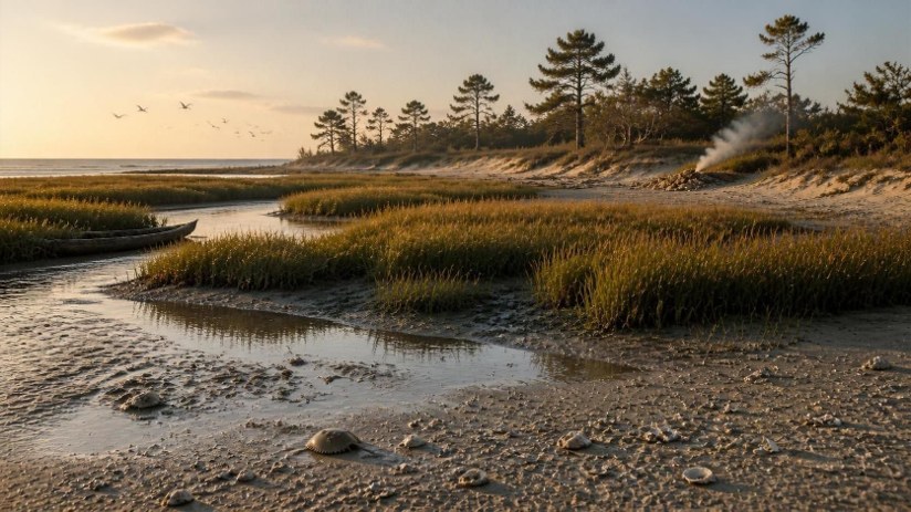
The area around Cedar Creek would have featured marshlands with grasses, sedges, and other wetland plants that thrive in coastal ecosystems. Upland areas were likely covered with hardwood forests, including species such as oak, maple, and hickory. Along the coastline, he would have found salt-tolerant vegetation such as beach grasses and sea oats, which help stabilize sandy dunes. Various wildflowers would have bloomed in the area, providing habitat for pollinators. The diverse ecosystems around Slaughter Beach in the 1600s would have provided a wealth of resources for early settlers like Captain Hart, facilitating both subsistence and trade, even possibly with the migrating native members of the Lenape tribe. The American shad and hickory shad were common in the rivers and coastal waters, especially during migration periods. Atlantic sturgeon, a significant fish species from the period, inhabited these waters. Various species of flounder would have been prevalent in the tidal zones. Menhaden, an Algonquin word, refers to a fish known for their use by the indigenous people as fertilizer with their crops. The area would have been home to numerous bird species, including shorebirds, wading birds, and migratory species like ducks and geese. Various mammals, such as fox, deer, and raccoons, occupied the woodlands and marshes. The region was likely host to several reptiles, including turtles and snakes, particularly in wetland areas. The coastal waters teemed with marine life, including crabs, oysters, and clams, contributing to the local economy through fishing and gathering.
This rich natural environment played a crucial role in the lives of the inhabitants and the development of the region. With abundance of natural resources it’s easy to understand why Captain Hart called this area “Hart’s Delight”.
While specific details of Captain Hart’s life, including his origins and the extent of his travels, remain largely undocumented, it is widely recognized that he played a role in the early development in Slaughter Neck. The strategic location of Hart’s Delight, with its access to fertile lands and the bustling waterways, exemplified the opportunities that drove many explorers to the region. As mariners and traders, figures like Hart were instrumental in mapping and claiming land in a time of rapid colonial expansion. Over time other historic Slaughter Beach families became owners of these lands: e.g. Fisher, Carter, Mills, Jackson, Pierce, Watson, Marshall, Pierce. Some properties are still owned and occupied by descendants of Drapers, Simpsons, Davis and Bennetts.
References:
- Wikipedia
- “The Mysterious Journey of Captain Hart and Other Tales” by B. Tessier
- ChatGPT (SBHS note: “Some content was created or assisted by artificial intelligence, and it may contain errors or require independent verification.”)
- Ancestry: Delaware history, Cedar Creek Hundred, Sussex County, Delaware
- Milford Times, July 7, 2025, Terry Rogers: History of Slaughter Beach
- Slaughter Beach Historical Society website: What’s in a Name