
In probably the mid 1700s to early 1800s, this early road may have extended from Cedar Creek Village, located at the crossroads of what is now Route 30/Cedar Creek Road and Pine Haven Road. This was a once thriving village on the King’s Highway and Cedar Creek, transporting goods from as early as the 1760s to mid- 1800s. Milling and transport of shipments of grain and lumber were important industries prior to 1769. Campbell’s Road would have traveled eastward toward Delaware Bay, going through another crossroad and small village at Argo’s Corner until it ended at the Bay, or the currently named Bay Avenue.
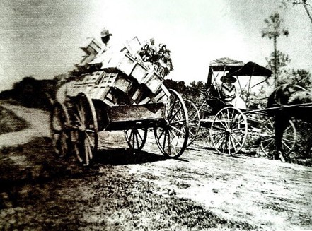
Prior to 1858, in earliest references to the area, this road to the Bay was called the “road to Campbell’s Beach” because the large property of 1210 acres (part farm, part marsh) closest to the beach belonged to several generations of the John Campbell family from 1772 until 1858. This was originally part of Alexander Draper’s holdings. It would have been rustic, maybe just an unpaved lane, used by early farmers to divide or travel to their properties. The “lane” is specifically mentioned in the 1810 will of John Simpson Campbell, Sr.(1743-1810), so was present before that date. It was designated a Public Road in 1811. In 1902, in letters from a surveyor named Hazzard, to Mary Davis, an adjacent land owner, he mentions that he “was fully convinced that it had never changed in its whole history”. Therefore, even then, this road had been in existence for approximately 100 years.
To make things even more confusing, there were several “John Campbells” who owned the property and also other farms along the road. These properties were sold or inherited within the Campbell family. While the two plots following from 1858 below are difficult for us to read and interpret, much can still be extrapolated. These plot plans are maps from the Orphans Court archives and were produced to dispose of the estate of John Simpson Campbell, Jr.(1770-1848) who died intestate. The first plot shows evidence of all 3 names we have determined to be used here…. Campbells Beach, Doctors Island, and even in several places S.L.A.U.G.H.T.E.R B.E.A.C.H. The plot plan below represents part of the area owned by John Simpson Campbell, Jr. Plot plan number 2 shows additional properties owned by the estate.
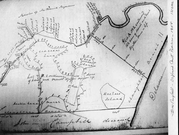
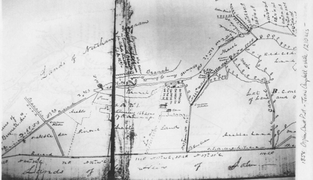
The 2nd plot below shows how many more parcels of the area were owned by John Simpson Campbell, Jr. and his heirs. While people north of us were getting ready for war in the late 1770s, the people in now Sussex County were busy developing this area. This map shows plots of arable land, marsh and was still very forested with many areas labeled “Red Cedar Lands”. These two surveys document the surrounding lands and owners, which is a characteristic part of deed construction even today.
As a footnote to the Campbell history, there was what appeared to be a tombstone found on the north side of Slaughter Beach Road where there were no graves present. This farm was known as the “Simpson Farm”. The 1210 acres of the original Campbell Farm was on the south side of the road. Jay Bennett found the stone and moved it to the house on the Campbell Farm.
The inscription on the tombstone says:
In Memory of
John Campbell
was born August 17, 1722
and departed this life
August 17, 1775
Aged 51 Years
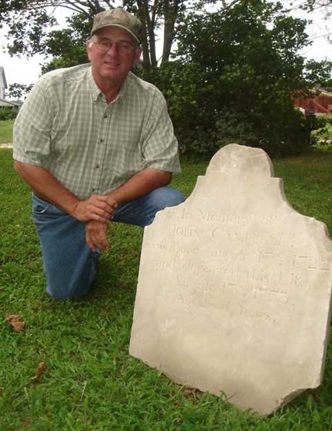
This stone raises a number of questions. The dates do not match with any John Campbells on Ancestry, The closest is John Campbell, Jr. (1720-1773) but he died in Worcester County, Maryland. Also, it is very unusual for the date to be exactly the same, August 17, but not impossible. Many gravestones of the era just had the year of birth and the year of death. Also, the stone says “aged 51 years” but according to the dates he would have been 53. Ultimately, the significance of the stone is unknown.
Information was compiled by Diane McFaul Hindman and Linda Bennett White. Information sources were Orphans Court documents, Dave Kenton’s Slaughter Beach historical articles, and Bennett Family deeds, letters, and other compiled research. July 2025.